Cairngorms Mountain Skills (1 Day)
A practical 1-day mountain skills course in the Cairngorms for walkers who want more confidence with navigation, route choice, mountain safety and independent decision-making in the Highlands.
- Meet in Aviemore
- Beginner Friendly
- Navigation & Hill Safety
- £110 Per Person
A practical introduction to mountain skills in the Cairngorms
Our 1-day Cairngorms Mountain Skills course meets at the Tiso Store in Aviemore. We use the Carrington Bothy Lecture Room for the initial briefing before heading onto the hill to put the day’s learning into practice.
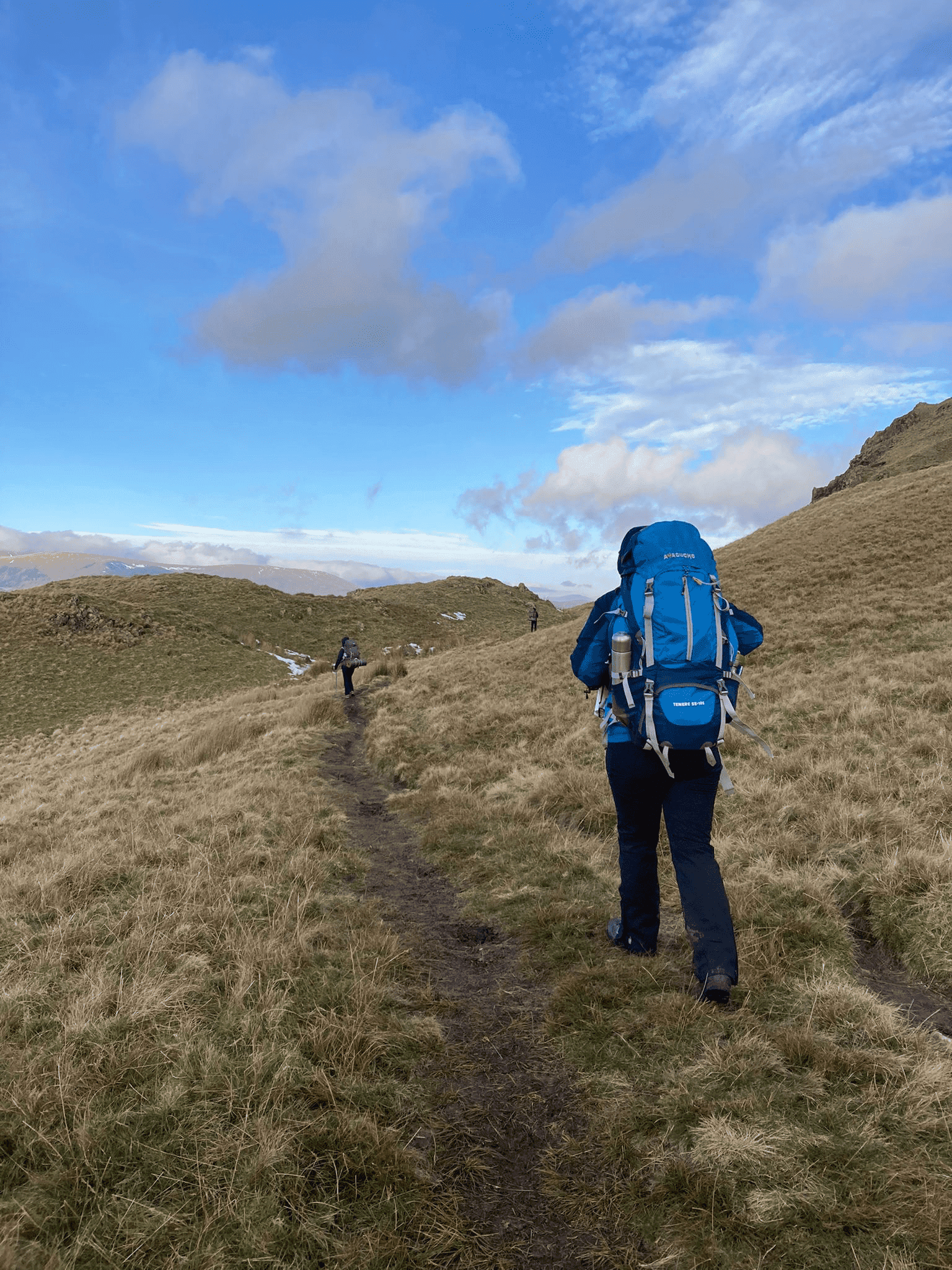
The Cairngorms provide an excellent setting for building strong navigation habits. The terrain is more open and expansive than many walkers are used to, making it an ideal place to develop map reading, direction, route choice and judgement in a real mountain environment.
This course is designed for beginners and developing hillwalkers who want a solid grounding in mountain navigation and safety without committing to a longer programme straight away.
Course details
- ✓ Meeting: Tiso Store, Aviemore
- ✓ Briefing: Carrington Bothy Room
- ✓ Duration: 1 day
- ✓ Ratio: Maximum 1:6 per instructor
- ✓ Focus: Navigation, planning and hill safety
- ✓ Bonus: 15% Cotswold / Snow+Rock discount
A strong first step for walkers who want more confidence before moving into longer or accredited courses.
What we cover
A practical one-day introduction to mountain navigation and hill safety, designed to give you useful skills you can apply straight away on your own days in the Highlands.
Navigation basics
- Map scales and symbols
- Orientating the map to the ground
- Identifying key landforms
- Pacing and timing distance
Compass & route tools
- Taking simple bearings
- Using handrails and attack points
- Collecting features
- Digital mapping and GPX overview
Safety & planning
- Weather forecast reading
- Safe route planning
- Hazard awareness
- Emergency procedures
Who this course is for
This 1-day course is aimed at beginners and developing hillwalkers who want to feel more capable in the mountains. You do not need advanced experience, but you should already enjoy walking and want to improve your judgement, navigation confidence and hill craft.
- Walkers beginning to move beyond obvious paths
- People wanting to rely less on phones and apps
- Anyone preparing for bigger mountain days
- Those wanting a practical and confidence-building refresher
Course progression
The 1-day course works well as a stand-alone skills boost, but it is also a useful first step into our longer Cairngorms Mountain Skills programmes.
If you want more time for deeper navigation practice and broader mountain judgement, the longer Cairngorms courses are the natural next step.
Dates & booking
Live availability is shown below. Booking secures your place and full joining instructions will be sent by email.
Before booking
- Meet at Tiso, Aviemore
- Initial briefing in the Carrington Bothy Room
- Course day approximately 09:00 – 17:00
- Hill clothing and sturdy boots required
Lake District Mountain Skills Courses
Prefer training on Lakeland terrain instead? We also run Mountain Skills courses in the Lake District, based from Keswick.
Lake District Mountain Skills (1 Day)
A practical one-day introduction to navigation and hill skills in the Lake District.
View 1-day course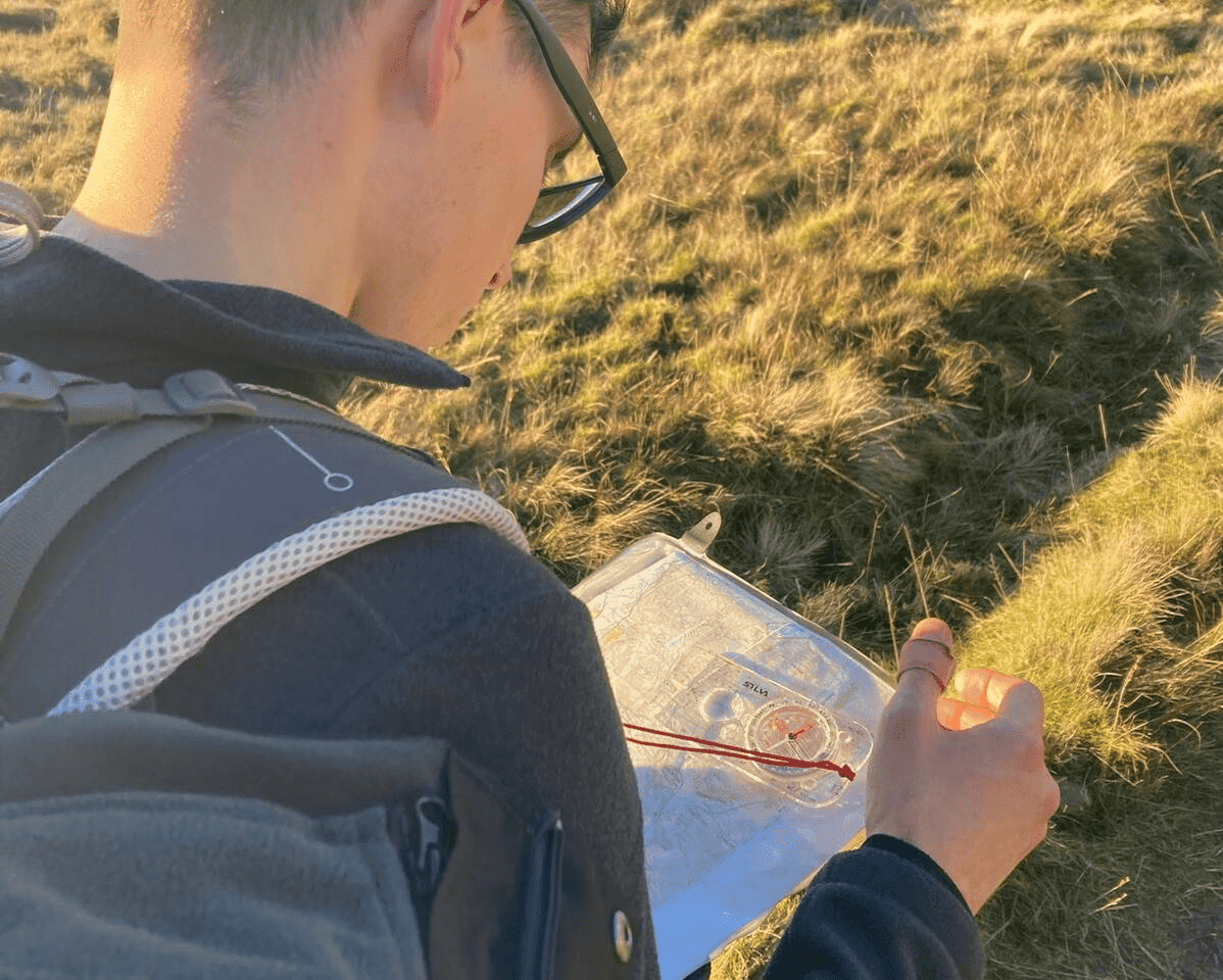
Lake District Mountain Skills (2 Day)
A structured two-day course covering navigation, route planning and mountain safety.
View 2-day course
Lake District Mountain Skills (4 Day)
A longer mountain skills programme with extra depth, night navigation and wild camp elements.
View 4-day course