Cairngorms Mountain Skills (2 Days)
A practical two-day mountain skills course in the Cairngorms following the official Mountain Training syllabus. Build navigation confidence, route planning and mountain judgement in the heart of the Highlands.
- Accredited syllabus
- Meeting in Aviemore
- 15% Gear Discount
- £155 Per Person
A structured mountain skills course in the Cairngorms
Our 2-day accredited course meets at the Tiso Store in Aviemore. We use the Carrington Bothy Lecture Room for planning and briefing before heading onto the hill, giving the course a strong mix of practical mountain time and clear structured learning.
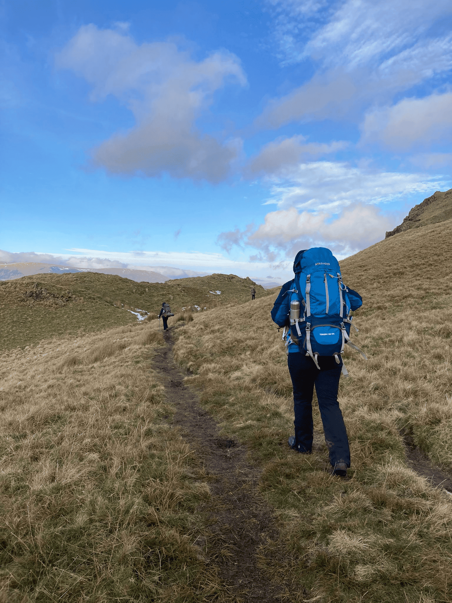
The Cairngorms are ideal terrain for this kind of course. The more open mountain environment helps walkers build stronger habits with map reading, contour understanding, route choice and judgement in a setting where navigation really matters.
Following the official Mountain Training syllabus, this course is designed for walkers who want recognised progression and a more complete step up from a simple taster day.
Course details
- ✓ Base: Tiso Aviemore (Carrington Bothy)
- ✓ Duration: 2 full days
- ✓ Syllabus: Official Mountain Training
- ✓ Accreditation: Mountain Training certificate issued
- ✓ Focus: Navigation, route planning and mountain safety
- ✓ Bonus: 15% Cotswold / Snow+Rock discount
Best for: walkers who want more time than a 1-day course allows, but do not need the full depth of a longer academy-style format.
Course syllabus
This course follows the recognised Mountain Skills syllabus and focuses on practical mountain navigation, safe movement and real-world decision-making in the Cairngorms.
Day 1: planning, movement & core navigation
We begin with map orientation and feature recognition before applying those skills on the hill in a practical Highland setting.
- Planning a route and understanding the mountain environment
- Map symbols, scale and grid references
- Feature recognition and contour interpretation
- Pacing, timing and judging distance
- Movement skills on varied mountain terrain
- Weather awareness and hazard identification
Day 2: compass work, relocation & safety
The second day develops more precise navigation and stronger mountain judgement, including relocation and safer movement in more serious terrain.
- Using the compass, setting the map and taking bearings
- Relocation: what to do when you are unsure of your position
- Steep ground safety and group management
- Weather awareness and emergency procedures
- Applying navigation tools under pressure
- Making better mountain decisions as a team or individual
Who this course is for
This course is aimed at walkers who already enjoy mountain days and want a more structured, recognised step forward. It suits those wanting stronger navigation, more confidence in poor visibility and better judgement in bigger terrain.
- Developing hillwalkers wanting a recognised progression route
- People ready to build stronger navigation and mountain judgement
- Walkers preparing for more independent or more serious routes
- Those wanting more than a simple introductory day
Shorter or longer options
If you want a shorter introduction, the 1-day Cairngorms course is a useful starting point. If you want more depth, the 4-day option allows more time for consolidation and broader mountain travel skills.
Most balanced option: the 2-day course is often the best fit for walkers who want recognised progression without committing to a longer block of training.
Dates & booking
Live availability is shown below. Booking secures your place and full joining instructions will be sent by email.
Before booking
- Meet at Tiso, Aviemore (PH22 1PT)
- Initial briefing in the Carrington Bothy Room
- Course days approximately 09:00 – 17:30
- Full mountain clothing and boots required
- Price includes Mountain Training registration and certificate fees
Lake District Mountain Skills Courses
Prefer Lakeland terrain instead? We also run Mountain Skills courses in the Lake District, based from Keswick.
Lake District Mountain Skills (1 Day)
A practical one-day introduction to navigation and hill skills in the Lake District.
View 1-day course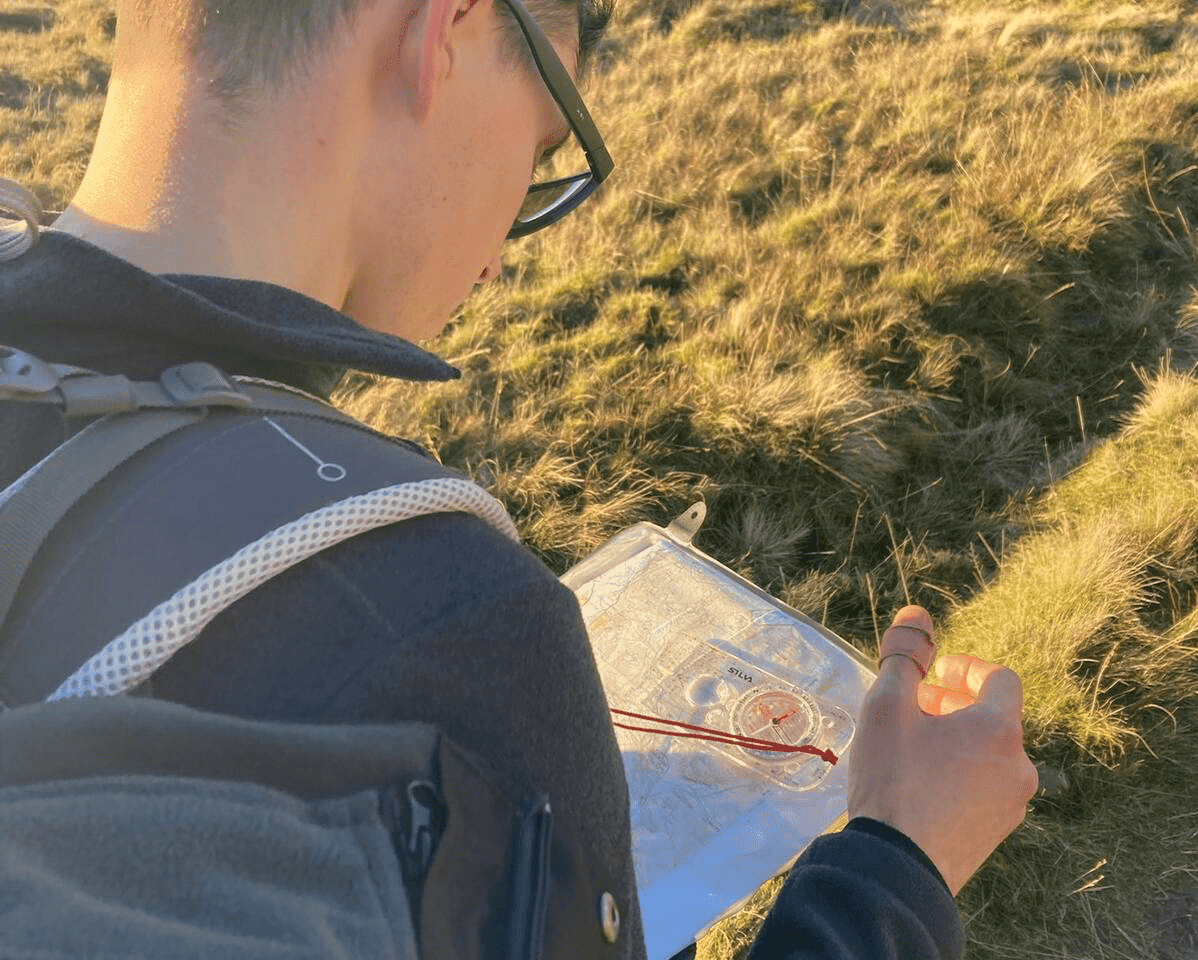
Lake District Mountain Skills (2 Day)
A structured two-day course covering navigation, route planning and mountain safety.
View 2-day course
Lake District Mountain Skills (4 Day)
A longer mountain skills programme with extra depth, night navigation and wild camp elements.
View 4-day course